Checkpoint 0: High Altitude Adventures rendezvous
Checkpoint 1: Ute Ulay/Hidden Treasure Dam Lookout
Checkpoint 2: Capitol City
Checkpoint 3: Engineer Pass Accent/Restroom
Checkpoint 4: Engineer Pass Sign
Checkpoint 5: Odom Point (Optional)
Checkpoint 6: Animas Forks/Restroom
Checkpoint 7: Cinnamon Pass
Checkpoint 8: American Basin (Optional)
Checkpoint 9: Burrows Park/Restroom
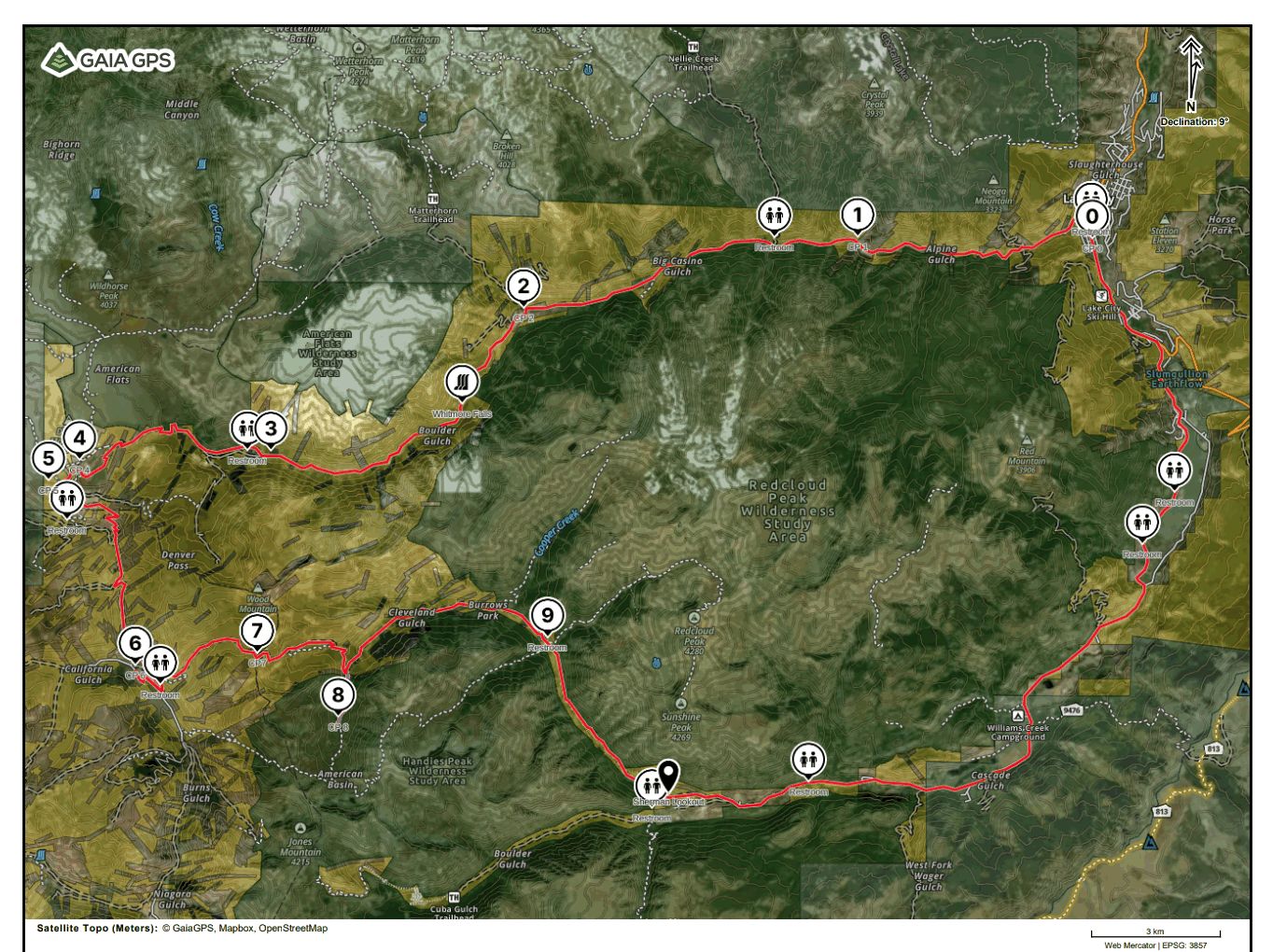
Points of Interest: Whitmore Falls, Odom Point, American Basin, Sherman Lookout, Lake San Cristobal Parking Area
The Alpine Loop is a scenic drive in Lake City, Colorado that offers stunning views of the surrounding San Juan Mountains. It is a 52-mile loop that traverses some of the most beautiful and rugged terrain in the state, including high mountain passes, alpine lakes, and historic mining towns.
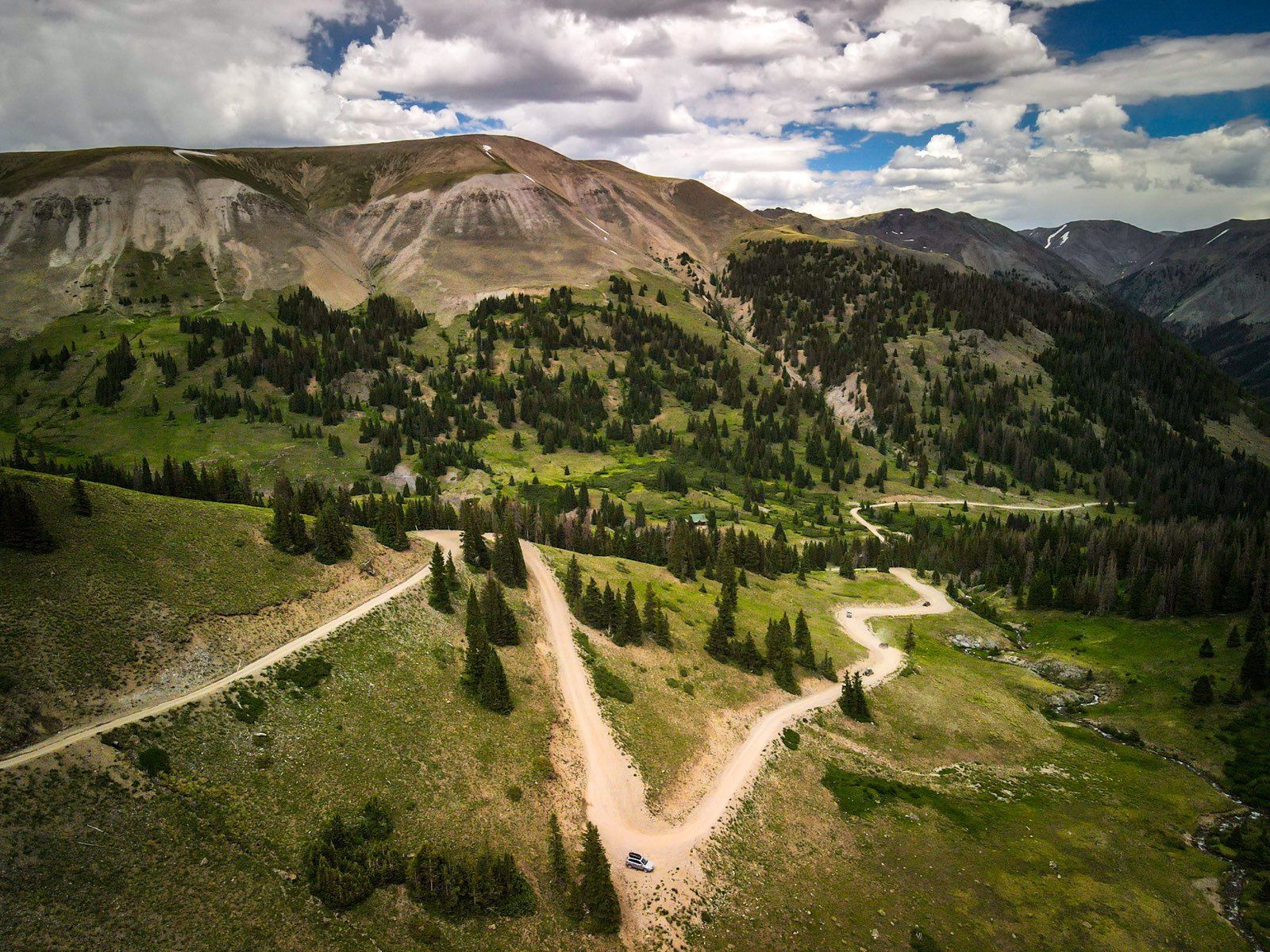
The Alpine Loop starts and ends in Lake City, a small mountain town in southwest Colorado. From there, it heads west on County Road 20 towards Engineer Pass, which reaches an elevation of 12,800 feet. This stretch of road offers stunning views of the San Juan Mountains, including the Wetterhorn and Uncompahgre Peaks.
After crossing Engineer Pass, the Alpine Loop continues south on County Road 2 towards the historic mining town of Animas Forks. This section of road is very rough and requires a high-clearance, four-wheel-drive vehicle. Animas Forks is a ghost town that was once a bustling mining community in the late 1800s.
From Animas Forks, the Alpine Loop continues east on County Road 5 towards Cinnamon Pass, which reaches an elevation of 12,640 feet. This stretch of road is also very rugged and requires a high-clearance, four-wheel-drive vehicle. The views from Cinnamon Pass are spectacular, with views of the surrounding mountains and valleys.
After crossing Cinnamon Pass, the Alpine Loop heads east on County Road 30 towards Lake City. This section of the road is a bit easier and offers more gentle terrain. Along the way, you'll pass by several alpine lakes and have stunning views of the mountains.
Checkpoint 0: High Altitude Adventures rendezvous
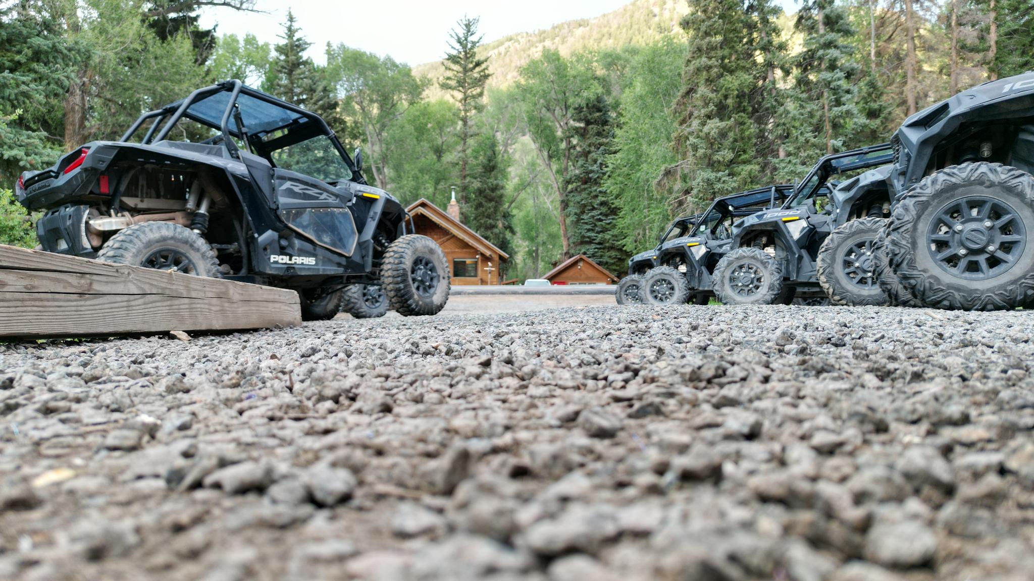
High Altitude Adventures has been in operation since the summer of 2016, it is veteran-owned and veteran operated with deep family roots in Hinsdale County. We have built a customer base that is interested in using our always newest model Polaris RZRs to reach a trailhead to summit one of our 5 fourteeners in the area, explore the rich mining history dating back to as early as 1871, or reach breathtaking views only accessible by a high-clearance reliable 4x4 vehicle. With over 116 5-star google reviews we show that we care about customer satisfaction, safety, and our machines.
Checkpoint 1: Ute Ulay/Hidden Treasure Dam Lookout
The Ute-Ulay mine was a historic mining operation located in the Lake City Mining District of Colorado, USA. The mine was established in the late 1800s, during the peak of the region's silver boom, and it was one of the largest and most successful mines in the area.
The Ute-Ulay mine was known for producing high-quality silver ore, as well as smaller quantities of other minerals such as lead, zinc, and gold. The mine was equipped with state-of-the-art technology, including underground railways and hoists, and it employed a large number of miners.
During its peak, the Ute-Ulay mine was a major contributor to the local economy, providing jobs and financial stability for the surrounding community. However, the mine faced challenges such as fluctuating silver prices, declining ore quality, and increasing costs.
In the early 1900s, the Ute-Ulay mine was closed, along with many of the other mines in the Lake City Mining District. The mine's buildings and equipment were either dismantled or left to decay, and the site was eventually abandoned.
Today, the Ute-Ulay mine is a popular tourist destination, attracting visitors who are interested in exploring the history of the American West and the mining heritage of the region. Visitors can tour the site and see the remains of the mine, including mining equipment and ore carts, as well as other artifacts related to the area's mining history.
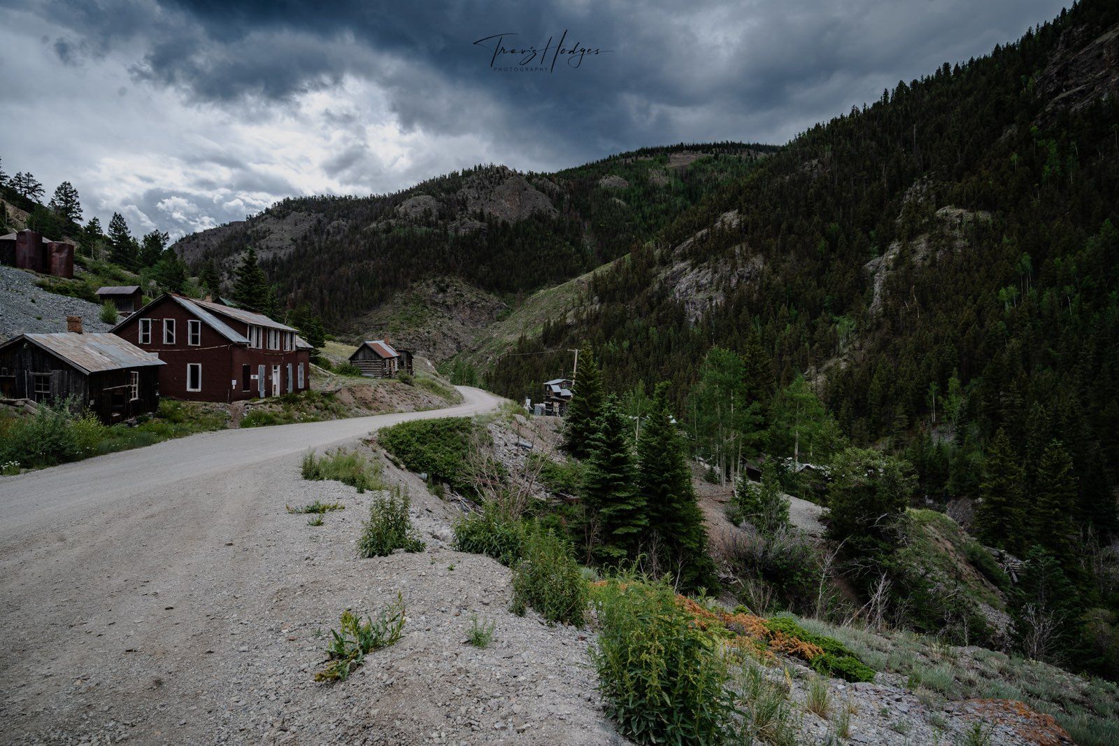
Checkpoint 2: Capitol City
Capital City is a ghost town located in the San Juan Mountains of southwestern Colorado, near the town of Lake City. The town was founded in the late 1870s during the Colorado mining boom and was named for the fact that it was intended to become the capital of Colorado. However, the town's population never grew large enough to support such a status, and the capital was eventually established in Denver.
The town of Capital City had a brief period of prosperity as a mining community, with several mines producing silver and other minerals. At its peak, the town had a population of around 300 people and was home to several businesses, including saloons, general stores, and a post office.
However, the mining industry in the area began to decline in the early 20th century, and by the 1930s, Capital City was largely abandoned. Today, the town is a well-preserved ghost town, with many of its original buildings and structures still standing.
Visitors can explore the ruins of the town, including the old schoolhouse, general store, and several houses. The town is accessible via a dirt road and is located in a scenic mountain valley, surrounded by rugged peaks and forests. The nearby town of Lake City also offers amenities such as lodging, dining, and shopping for visitors who want to explore the area.
Checkpoint 3: Engineer Pass Accent/Restroom
Checkpoint 4: Engineer Pass Sign
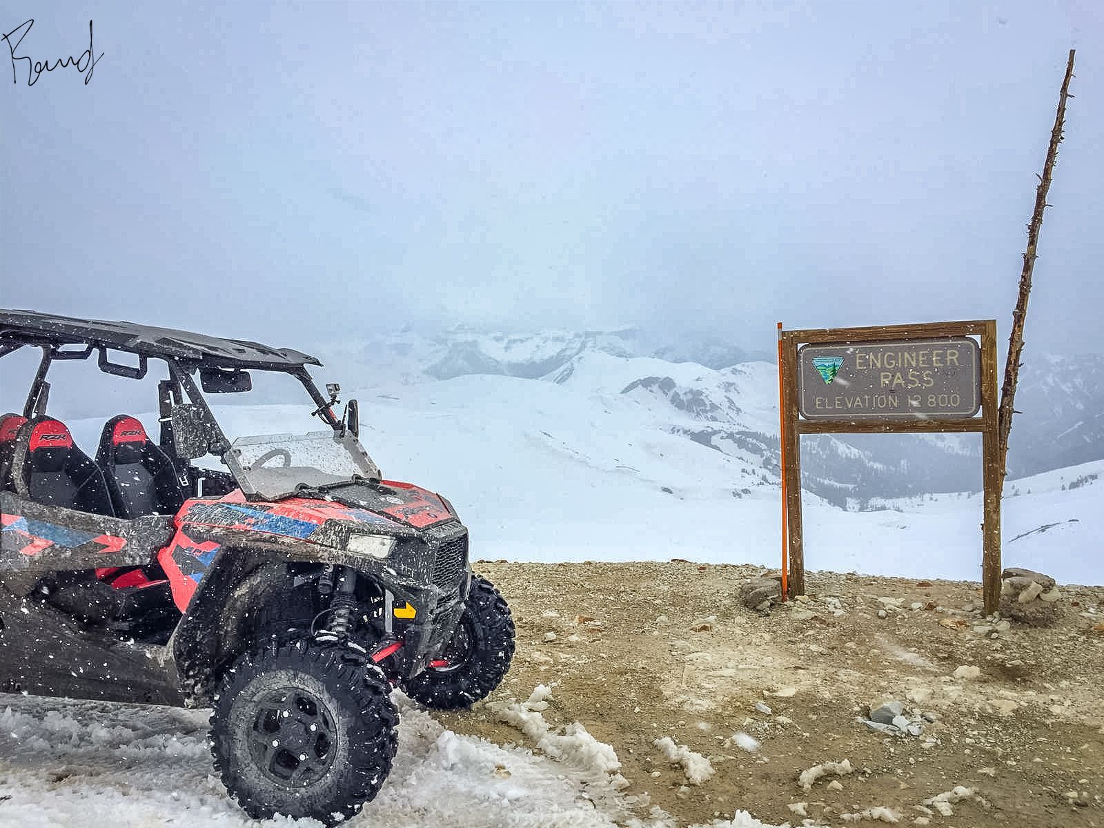
Engineer Pass is a high mountain pass located in the San Juan Mountains of southwestern Colorado, near the town of Lake City. The pass sits at an elevation of 12,800 feet (3,901 meters) above sea level and is part of the Alpine Loop Scenic Byway, a 52-mile backcountry route that winds through some of the most scenic and historic parts of the San Juan Mountains.
The pass is named after the San Juan Mining and Reduction Company's engineers who built the road over the pass in the late 19th century. The road is unpaved and can be steep and rocky in places, so it is recommended for four-wheel drive vehicles only. It is also closed during the winter months due to heavy snowfall and can typically only be accessed from late spring to early fall.
The pass offers stunning views of the surrounding mountain landscape, including several 14,000-foot peaks such as Uncompahgre Peak and Wetterhorn Peak. It is also home to several historic mining sites, including the ghost town of Animas Forks, which was once a thriving mining community in the late 19th century.
Checkpoint 5: Odom Point (Optional)

Odom Point is a prominent summit located in Hinsdale County, Colorado. It is situated in the San Juan Mountains and is part of the Uncompahgre National Forest. Odom Point has an elevation of 13,114 feet (3,997 meters) and offers breathtaking views of the surrounding landscape.
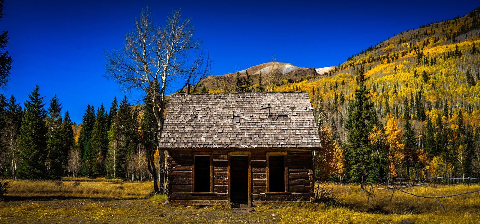
Checkpoint 6: Animas Forks/Restroom
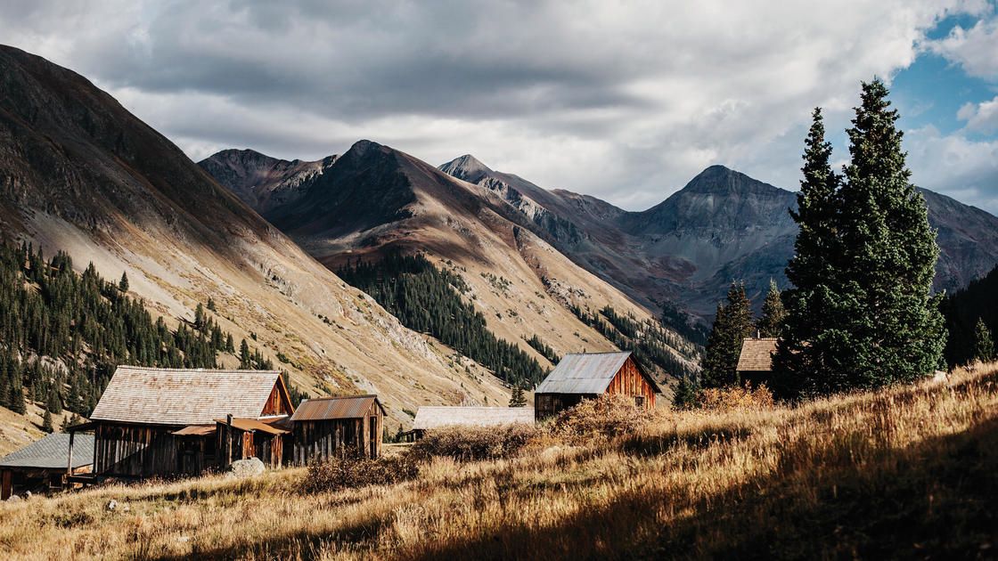
Animas Forks is a ghost town located in the San Juan Mountains of southwestern Colorado, near the town of Lake City. The town was founded in the late 1870s during the Colorado mining boom and was named after the nearby Animas River.
At its peak, Animas Forks was a thriving mining community with a population of over 450 people. The town had a number of businesses, including several saloons, general stores, a post office, and a newspaper. The town also had a number of residential homes, many of which were built with locally sourced timber and stone.
The mining industry in the area began to decline in the early 20th century, and by the 1920s, Animas Forks was largely abandoned. However, many of the town's buildings and structures have been well-preserved, providing visitors with a glimpse into the town's past.
Today, visitors can explore the town's historic buildings, including the old jail, the Duncan House (one of the town's most well-preserved homes), and the Gold Prince Mill, which was used to process ore from the nearby mines.
Animas Forks is accessible via a dirt road and is located in a scenic mountain valley, surrounded by rugged peaks and forests. The town is a popular destination for history buffs, outdoor enthusiasts, and photographers, and is part of the Alpine Loop Scenic Byway, a 65-mile backcountry route that winds through some of the most scenic and historic parts of the San Juan Mountains. The nearby town of Lake City also offers amenities such as lodging, dining, and shopping for visitors who want to explore the area.
Checkpoint 7: Cinnamon Pass Sign
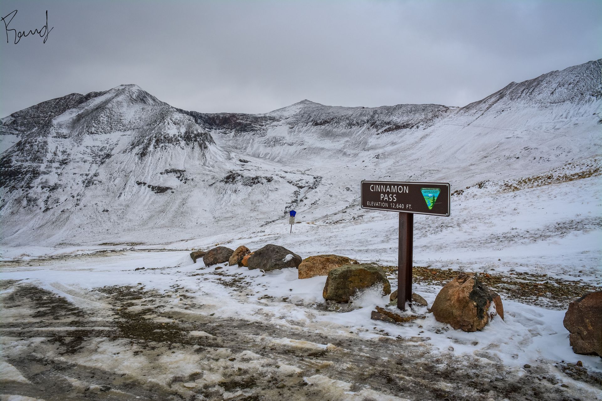
Cinnamon Pass is a high mountain pass located in the San Juan Mountains of southwestern Colorado, near the town of Lake City. The pass sits at an elevation of 12,640 feet (3,853 meters) above sea level and is part of the Alpine Loop Scenic Byway, a 65-mile backcountry route that winds through some of the most scenic and historic parts of the San Juan Mountains.
The pass is named after the cinnamon-colored rocks that are found in the surrounding peaks, and it offers breathtaking views of the rugged mountain landscape, including several 14,000-foot peaks such as Handies Peak, Redcloud Peak, and Sunshine Peak.
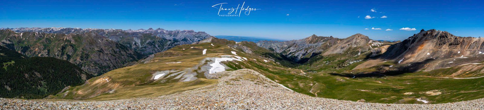
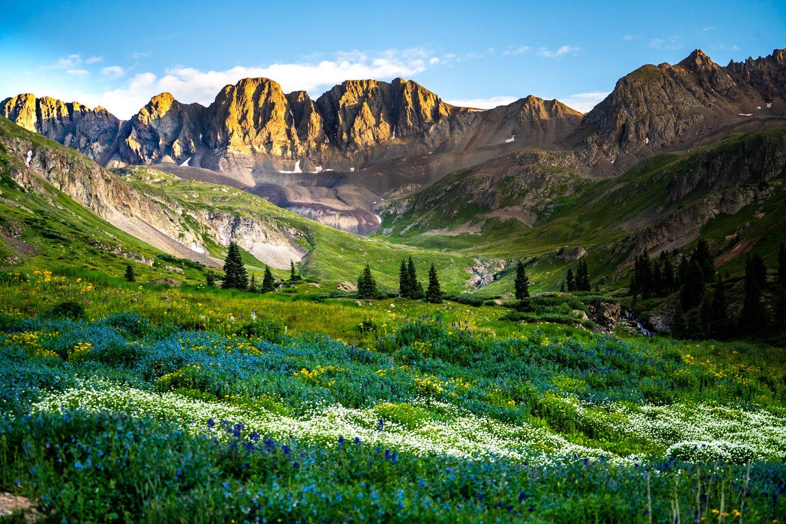
Checkpoint 8: American Basin (Optional)
 Taken by Travis Hodges ~ 20JUL22
American Basin is a popular hiking and camping area located in the San Juan Mountains of southwestern Colorado, near the town of Lake City. The basin is located in the Uncompahgre Wilderness Area and is known for its stunning alpine scenery, wildflowers, and mountain views.
The basin can be accessed via a rough dirt road that leads up from the town of Lake City. The road can be steep and narrow in places and is not recommended for vehicles without four-wheel drive. Once in the basin, visitors can explore a network of hiking trails that wind through the valley and up into the surrounding mountains.
One of the most popular hikes in the area is the American Basin Trail, which leads to a high alpine lake known as Blue Lake. The trail is about 6 miles round-trip and is considered moderately difficult, with a steep climb up to the lake. However, the views from the top are well worth the effort, with panoramic views of the surrounding peaks and valleys.
Other popular hikes in the area include the Handies Peak Trail, which leads to the summit of Handies Peak, a 14,058-foot peak with stunning views of the surrounding mountains. There are also several camping areas in the basin, with primitive campsites available for those who want to spend more time in the area.
Checkpoint 9: Burrows Park/Restroom
One of the most popular hikes in the area is the Burrows Park Trail, which leads to the summit of Redcloud Peak, a 14,041-foot peak with stunning views of the surrounding mountains. The trail is about 8 miles round-trip and is considered moderately difficult, with a steep climb up to the summit. However, the views from the top are well worth the effort, with panoramic views of the San Juan Mountains.
Other popular hikes in the area include the Sunshine and Sundog Trails, which offer scenic views of the valley and surrounding peaks. There are also several camping areas in the park, with primitive campsites available for those who want to spend more time in the area.